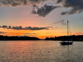
Day 66: To Lime Island
Day 66: September 22: Being in the Soo, and with Walmart SuperCenter about 3 miles away, it's a good time to re-provision. John asked the person working in the office about the availability of taxis, ubers, busses. It was recommended we take the municipal bus which ran every hour. The stop was about a 3 minute walk from the marina. We arrived at the stop about 5 minutes before the scheduled time. By the time about 25 minutes had passed we began to question whether the bus was running since it was late in the season or if it had come early and just passed by seeing no one waiting. John contacted what he thought was the U.S. bus terminal but actually dialed the Canadian number. It was no wonder the lady on the other end of the phone had no idea where he was standing. 😅😅😅 She finally realized we were on the U.S, side! We had a good laugh over that!
We eventually called the right number and were told the bus was indeed running and would be there shortly. Sure enough, a van pulled up at 10:20 and we boarded. We were the only passengers on the van the entire time as the driver made his way around his scheduled stops. He was very nice and acted like a tour guide, telling us about the history of the Soo; he had grown up on Whitefish Point where he still had a place so was very knowledgeable about the entire area.
Before we got to the store, John asked him if it was okay if we brought packages onboard after we shopped. He told us that was fine, pointed out where the bus would pull up and noted the next pick-up time was 1:00. That would leave us plenty of time for shopping.
After checking out, our friends Sandra and David mentioned they had seen a sign on the bus that said only 1 package per rider was allowed. Uh Oh! Between the 4 of us we had about 15 bags and cases of water and soda. To top it off John bought 2-5 gallon drums of oil in addition to 5 extra quarts; all needed for an upcoming oil change. We were happy when we saw the same bus driver pull up! We loaded up and made the trip back to the marina. The roundtrip coast each couple $8.00 (the senior citizen rate). 😅😅😅
Back at the marina we heard the Mackinaw bellowing out her intention to get UW. As she pulled out, people on shore as well as on the boat were waving and cheering and music was playing. She began her departure and saluted the CG boats at the dock with 3 long and 2 short blasts. This was followed by a responding call of 1 long and 2 short. A.J. told us the 3 long/2 short is the Master's salute while 1 long/2 sort is the Captain's salute. It felt like a giant celebration!


We got UW at about 2:30 under beautiful weather conditions and traveled down-bound on the St. Marys through the channel on the west side of Neebish Island. I just found out that the St. Marys River is actually a strait it's a series of connected lakes that include Mud Lake, Lake George and Whitefish Bay. For its entire length it is an international border between Michigan and Ontario, Canada.
Before the 1900's two way transportation on the St. Marys flowed along the east side of Neebish Island through the Neebish rapids and on the back side of Neebish Island. The stretch on the west Neebish rapids was shallow and rocky. In 1902 work began to create an additional channel along the west. Drilling and blasting of the limestone bedrock carved out the Rock Cut which is 1 mile long, 20 feet deep and 300 feet wide.
The canal opened in 1908 and by 1920 the traffic pattern requires up-bound vessels to move through the shallower canal through the middle Neebish Rapids and down-bound loaded traffic to travel through the Rock Cut, thereby reducing accidents and congestion. With the increasing size of vessels using the Cut, a new project began in the 1930's and the Cut was deepened to 25 feet.
It's not a very pretty passage but knowing the history of it made it an interesting trip!


Comments
Post a Comment