Day 128: November 23: John must have gotten confused and missed a turn. We have to be heading north; it was freezing this morning. When I signed up for this cruise I did not sign up for 30 degree temperatures. Just like at home, the combination of 60 degree water and 30 degree air resulted in pretty thick fog on the river. For a short time we couldn't see onto the banks of this inlet, never mind beyond the entrance to the river. No sense leaving in the fog so onto plan B; a second cup of coffee.
At around 9:00 a.m. the fog started to clear; first in the creek then the river. We started the engines, leaving time for them to warm up properly. John took the dinghy back to the tree area and untied the stern line. We were pleased that the slight current running through the creek did not turn the boat toward the line of stumps. Given that we would only be traveling a few hours down Pickwick Lake today we didn't bother to pull the dinghy onboard. Towing would suffice!
Unlike yesterday the sun came out, warming up the air and us. There was no wind and the lake was like glass. Cruising along is so much more enjoyable when you aren't chilled to the bone; I am thankful on this Thanksgiving day for that bright yellow star in the sky; for its warmth and the brilliance it creates along the waterway.
A total of two speedy bass boats and one barge passed us by as we traveled the 30.8 NM to our destination. I suppose most people are home getting ready for the holiday; a feast, football and a nap.
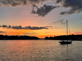
I was really looking forward to today; the day we would begin our travels on the Tenn-Tom Waterway at Mile Marker 215.2 of the Tennessee River on Pickwick Lake and truly be southbound. We turned into Yellow Creek at the Mississippi and Tennessee state border. This is the point where Alabama, Tennessee and Mississippi meet. Mobile here we come.
 |
Three states meet on Pickwick Lake
|
We passed the Grand Harbor Marina and Resort; Grand is certainly a perfect descriptor. Looking on the NEBO APP I see many Loopers are here as well as Safe Harbor Aqua Yacht nearby. Not needing to stay at a marina, we headed for an anchorage.
John received a call on the radio from a barge asking our intention; it was heading up bound, just rounding a bend. Luckily we would not be meeting up as we were pulling to port into one of the inlets surrounding Yellow Creek Island. There are three bays along this area that are suitable for anchoring. We ended up dropping the hook in about 14 feet in a pretty and tranquil spot with ample swing and space. A few fishermen were trolling along the shoreline, inspiring John to try his hand. Even with a new lure he had no luck.
The family called to wish us a Happy Thanksgiving! As in the past they were at Craig's house and had just finished desert. Craig was evil, showing us all the tempting sweets everyone enjoyed!
Yellow Creek Island was formed by a dredged channel on the eastern side. Regular barge traffic flows through the channel. We saw one barge and one tug without barges pass by the opening in addition to the one that came through just before we turned in to the cove. I also noticed 2 Loopers pass by; I'm assuming they were headed to Safe Harbor Aqua Yacht.
The Navionics APP shows where we turned off the Tennessee and onto Yellow Creek. NEBO captures the spot where the three states come together.


Comments
Post a Comment