Day 193: Okeechobee Waterway Leg 1
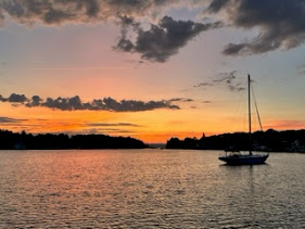
Day 193: January 27: Today's sunrise was majestic; the sky filled with vibrant hues of orange, pink and gold, nature's way of telling us it was a new day filled with incredible possibilities. Matanzas Harbor woke early, boats beginning their day's trips at first light. As we prepared to release from our mooring, we watched the Key West Express ferry get UW, loaded with passengers looking forward to a day in the Keys.


It promised to be a beautiful day and we were looking forward to our next adventure. We meandered out of Fort Myers Beach (Matanzas Municipal Mooring Field) and headed out into the Gulf for a short passage into the Okeechobee Waterway. (OWW). Passing under the Sanibel Causeway, we spotted the buoys leading into this segment of our voyage. This stretch of the waterway, the Caloosahatchee River, was alive with boats, mostly center consoles probably racing to and fro hoping for a good day of fishing. We were amazed at the number whizzing by this narrow channel; it's obviously a very popular place.


The Lake Okeechobee Waterway is a 154-mile long waterway. It begins with the 67-mile-long stretch of the Caloosahatchee River which connects the lake to San Carlos Bay at Sanibel Island on the Gulf and ends at Stuart, at the St. Lucie Inlet at the junction of the Atlantic Intracoastal (ICW). Known as Florida's Inland Sea, Lake Okeechobee is the largest freshwater lake in the state of Florida and the second largest freshwater lake contained entirely within the United States. For such a large lake, it is exceptionally shallow, with an average depth of only 9 feet and a soft muddy bottom.
Not being a sea level canal, the OWW uses locks to raise vessels from sea level to the level of the lake and then lower them back down to sea level on the other side. There are 5 locks on the OWW. From west to east they are the W.P. Franklin, Ortona, Julian Keen, Jr. (formerly the Moore Haven), Port Mayaca and the St. Lucie. The Clewiston Lock is an additional lock only used to enter the town of Clewiston or make a stop at its marina. Locks on the OWW are different from all other locks in North America in that they do not use valves to let water into the lock. Instead, the front gates on the high side of the canal are opened about a foot and water pours into or out of the chamber.
There are also a number of bridges along the waterway, fixed, drawbridges and bascule. Most of the railroad bridges remain open unless a train is expected so boaters usually can pass right through.The Beautiful Island Railroad Bridge was the first low bridge we came to. With a vertical clearance of 5' when closed, the bridge was already in a open position.


At Mile 121.4 we approached the W.P. Franklin Lock. This lock is 400' long and 56' wide with a depth over the sills of 14'. It lifts a mere 2.5'. We called the lock master on channel 13 and proceeded into the chamber. The young lock master came out onto the platform and handed me a line at the bow. John then came down and grabbed a line at the stern. We worked together to prevent the boat's stern or bow from swinging out too far as the front gate opened and water began to pour in.


We approached the Alva drawbridge which reports a vertical clearance of 23'. The board read a bit less than that so we needed to ask for an opening. Just as John picked up the radio to call, a west bound boat contacted the bridge. The bridge tender advised he would open and the west bound should travel through first.


The second bridge was the Fort Denaud Swing Bridge. Like the others it opens on signal; but this one was a bit unique. The very nice bridge tender had to walk back and forth to the middle of the bridge to operate it. She was so kind, apologizing for delaying us. As we passed through, she stood on the center of the track, singing out "it's a beautiful day, have a good one"!


One thing in particular that caught my eye was people putting on a thatched roof. There are many thatched roof decks and huts as well as boats in Florida; it was fun seeing one being built. I also enjoyed the various vegetation; trees covered in a tangled web of Spanish moss and stark naked ones which I believe might be mesquite.


We pulled into the La Belle City Dock which was reported as a free stop with water and electricity. The dock was really not meant for large boats like ours but we managed, with the help of a Canadian couple already docked, to back in and tie up to the pilings. While our bow was sticking out toward the channel, with no current or wind, and a strong tie up, we were secure for the night.


Traveling this segment of the waterway was interesting to say the least. The 6 1/2- 45 NM trip had much to offer. While the first few miles were chaotic with plenty of traffic; sailboats, fishing boats, pleasure craft and jet skis sped by from all directions, throwing wakes at everyone, the latter part of the trip was much more peaceful. I would compare the first section to a large parking lot; the ones with Burger Kings, Wendy's, retail stores and Dunkin's and no painted lines so people just drive however they want. Once past the Fort Myers area, things settled down, eventually we didn't see another boat for quite awhile. Just us and nature. I'm amazed to think in two more days we will have traveled completely across the state of Florida.


Comments
Post a Comment